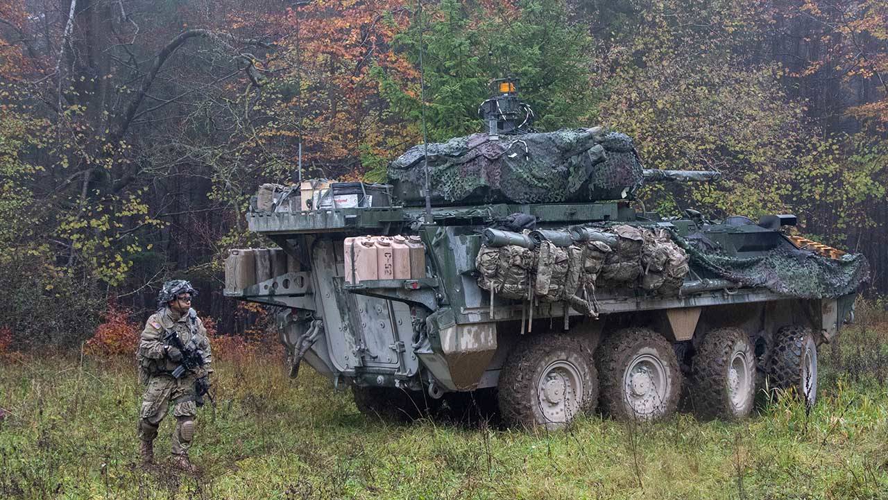
The U.S. Army’s 2nd Calvary Regiment MAPS GEN-1 Equipped Strykers will Provide Soldiers with Accurate and Trusted Positioning, Navigation and Timing Data. (Photo Credit: U.S. Army)
COLORADO SPRINGS, CO – On September 18, in Vilsek Germany, GPS Source and US Army Project Manager Positioning, Navigation, and Timing (PM PNT) started fielding the Mounted Assured PNT System (MAPS) Gen 1 system under the MAPS program of record. The GPS Source developed and manufactured MAPS Gen 1 system is now installed onto select Stryker vehicles belonging to US European Command as part of a fielding effort that is expected to cover thousands of vehicles in Europe.
“The MAPS GEN 1 Assured PNT system that is being fielded today closes a capability gap for the U.S. Army in major areas of responsibility around the world,” said Robert Horton, Vice President and Director for PNT Products at General Dynamics Mission Systems. “The GPS Source employees are excited to deliver such an important capability and to contribute to the safety of America’s soldiers.”
The US Army’s Project Manager for Positioning, Navigation, and Timing (PM PNT) lead this initiative as the Army’s lead acquisition developer tasked with developing, modernizing, and integrating optimal and affordable PNT capabilities to promote decisive action in Army Operations. As part of the Program Executive Office, PM PNT collaborates with other Army and Joint Service partners to develop interoperable, reliable products to promote real-time secure PNT services for a variety of combat and combat support field missions.
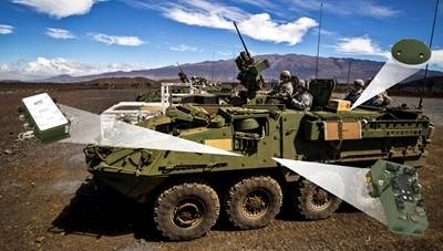
GPS Source has developed the SENTRySCOUT™ system, the foundation for MAPS Gen 1, with the goal of creating a complete system solution to fill an urgent capability gap to give warfighters the ability to shoot, move, and communicate in GPS challenged or denied environments. The system is based on GPS Source’s Enhanced D3 (DAGR Distributed Device) PNT hub with multiple capabilities including anti-jam antennas and is optionally upgradeable to incorporate data from an Inertial Navigation System.
More about GPS Source, Inc:
GPS Source, a wholly-owned subsidiary of General Dynamics Mission Systems, is a manufacturer of Global Navigation Satellite System (GNSS) positioning, navigation, and timing (PNT) solutions, and services. GPS Source serves the Department of Defense, the federal government, public safety, commercial electronics, survey, telecommunications, aerospace, automotive, and other demanding markets designing, developing, and manufacturing GPS transmission and validation components and systems. Their solutions support critical mission communication and enable GPS equipment to acquire signals in otherwise denied environments, such as in the cargo compartment of aircraft, maintenance hangars, train tunnels, etc.
About General Dynamics Mission Systems:
General Dynamics Mission Systems is a business unit of General Dynamics (NYSE: GD). For more information about General Dynamics Mission Systems, visit gdmissionsystems.com and follow us on Twitter @GDMS.


